
Significant Surface Low Tracks
Storm Tracks
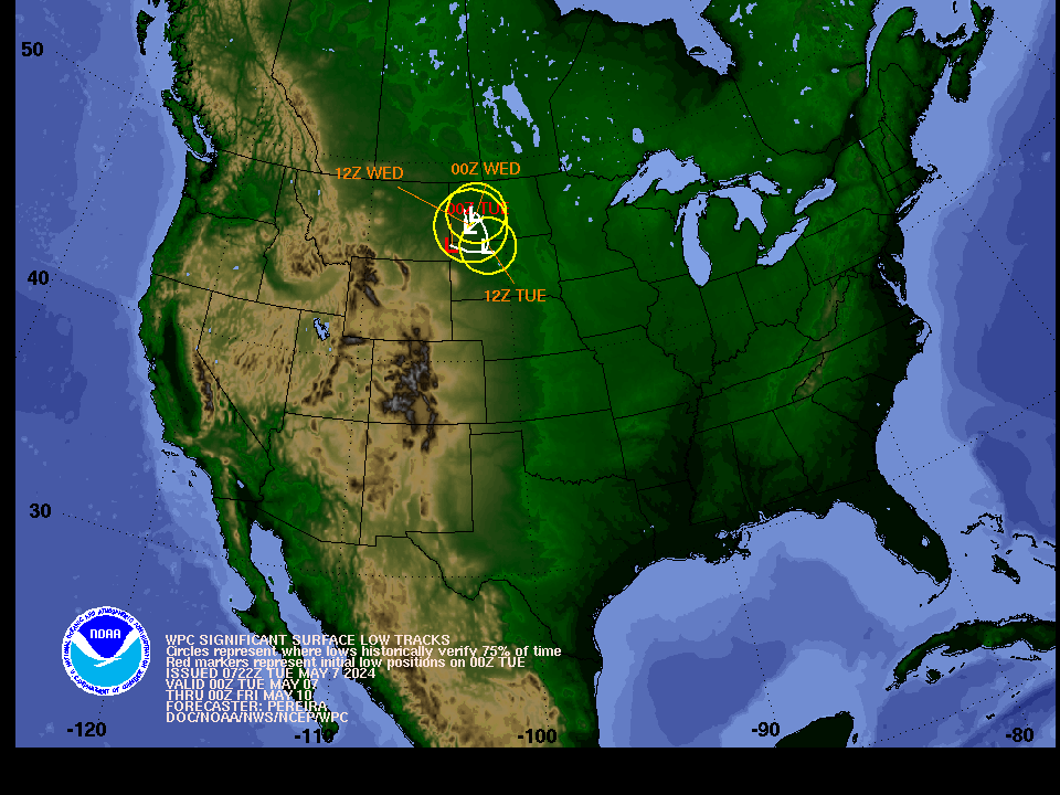
The graphic depicts the forecast location of significant surface lows impacting the 48 contiguous United States in 12 hour increments out to 72 hours into the future.
The low position and track forecast by NCEP WPC meteorologist is in white. Each low position is accompanied by a lead time (Eastern Time). The circles around each low represents a 75% probability the observed low will be located with the circle. Note: The probability is derived using previous season's verification data. For reference, existing surface lows are depicted with a red marker without yellow circles.