NOAA Storm Prediction Center
Convective Outlooks
Convective Outlooks
The convective outlooks serve as guidance to the local NWS forecast offices and are used by emergency managers, private sector meteorologists, media, and other weather customers concerned with public safety. Three separate risk areas (slight, moderate, and high) are used to describe the expected coverage and intensity for the categorical severe weather threat on days 1-3 along with severe weather probabilities for the potential threat.
|
|

Categorical Day1 1300Z Outlook
|
|

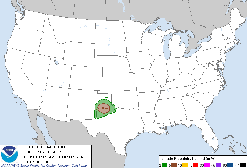
Probability of a tornado within 25 miles of a point.
Hatched Area: 10% or greater probability of EF2 - EF5 tornadoes within 25 miles of a point.
|
|

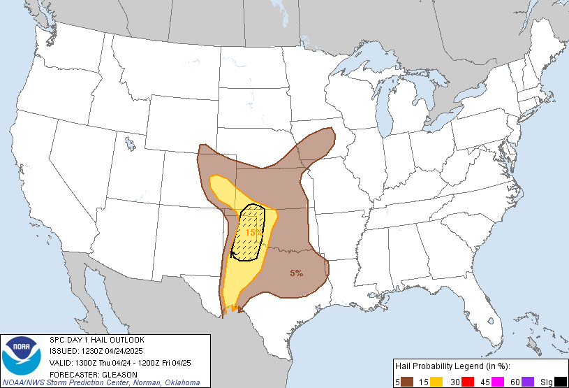
Probability of one inch diameter hail or larger within 25 miles of a point.
Hatched Area: 10% or greater probability of two inch diameter hail or larger within 25 miles of a point.
|
|

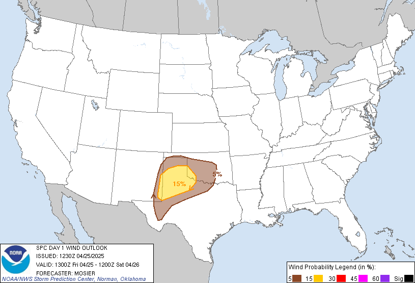
Probability of damaging thunderstorm winds or wind gusts of 50 knots or higher within 25 miles of a point.
Hatched Area: 10% or greater probability of wind gusts 65 knots or greater within 25 miles of a point.
|
|
|
Images courtesy of the NWS Storm Prediction Center
000
ACUS01 KWNS 201237
SWODY1
SPC AC 201235

Day 1 Convective Outlook
NWS Storm Prediction Center Norman OK
0735 AM CDT Sat Apr 20 2024

Valid 201300Z - 211200Z

...THERE IS A MARGINAL RISK OF SEVERE THUNDERSTORMS THIS AFTERNOON
THROUGH LATE EVENING ACROSS CENTRAL/SOUTH TX...AND FROM SOUTHERN MS
TO SOUTHERN NC...

...SUMMARY...
Marginally severe storms capable of strong wind gusts and hail will
be possible mainly this afternoon/evening across portions of central
and south Texas, and from southern Mississippi to southern North
Carolina.

...TX into the Southeast this afternoon/evening...
South of a midlevel trough over the Great Lakes, a southern-stream
shortwave trough will progress eastward from southern AZ/NM toward
the lower MS Valley by Sunday morning.  An associated surface
baroclinic zone from south TX into the Carolinas will move only
slowly southward through the period, providing a focus for isolated
to scattered thunderstorm development.  The more widespread
convection is expected across TX near and to the north of the front,
based on proximity to the richest moisture and the southern-stream
trough.

Boundary-layer dewpoints in the 60s and surface heating in cloud
breaks will drive MLCAPE in the 1000-2000 J/kg range immediately
south of the front across the Southeast this afternoon.  Vertical
shear will be relatively weak as a result of westerly wind profiles
with only modest speed increases from the low to midlevels.  The
moderate buoyancy, weak vertical shear and steep low-level lapse
rates will favor isolated strong/damaging outflow gusts for a few
hours this afternoon/evening.

Richer low-level moisture (dewpoints in the lower 70s) and steeper
midlevel lapse rates will be present across south TX through this
evening.  Initially elevated convection is expected to increase atop
the frontal surface from west central into central TX, and some of
this convection will approach the surface front this afternoon.
Separate surface-based thunderstorm development is also expected
along the front, and the storms will subsequently spread
east-southeastward into early tonight.  Despite MLCAPE potentially
exceeding 2000 J/kg, the steeper lapse rates will be relatively high
in the profiles (above the 700 mb level), and vertical shear will
not be particularly strong.  Though isolated large hail and wind
damage will be possible, along with some clustering of storms later
this afternoon into early tonight, a MRGL risk (5% hail/wind and 2%
tornado) appears to best characterize the overall severe threat in
TX.

..Thompson/Kerr.. 04/20/2024

$$

